Mount Kilimanjaro
Africa's highest peak, five climates in one climb. Uhuru Peak stands 5,895 m above Tanzania. The volcano's three cones, its shrinking ice, the main routes and how to reach the top.
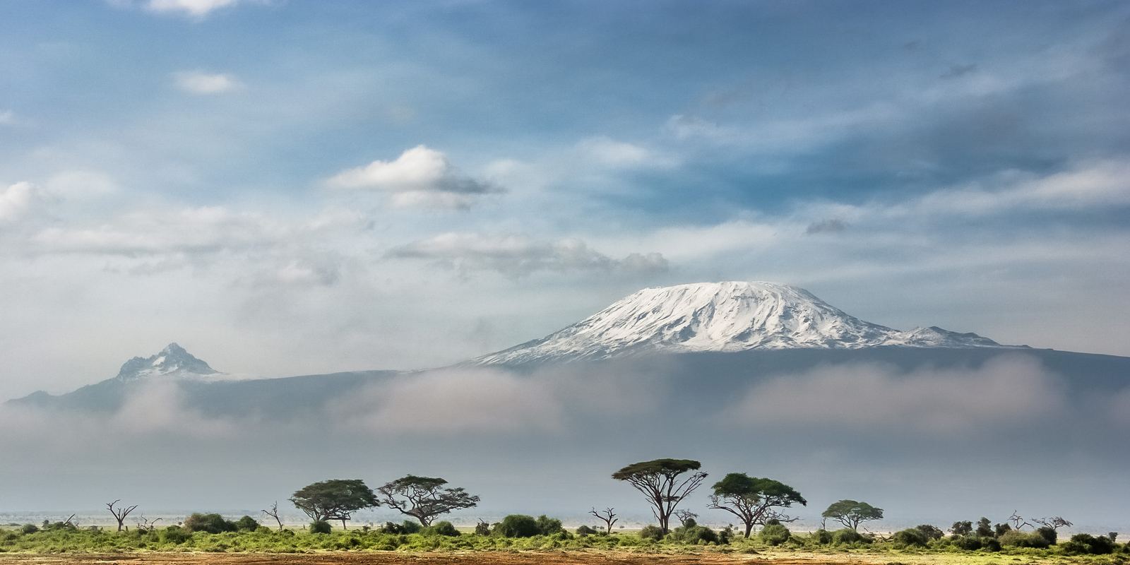
Kilimanjaro seen from Amboseli: Sergey Pesterev, CC BY-SA 4.0
A volcano standing alone
Kilimanjaro is the highest mountain in Africa and one of the highest free-standing mountains on Earth: it rises about 4,900 m above the surrounding plains rather than sitting in a long range. It is a stratovolcano made of three cones. Shira, in the west, is the oldest and has collapsed into a broad plateau. Mawenzi, in the east, is a jagged eroded peak reaching about 5,149 m.
Kibo, the central and youngest cone, holds Uhuru Peak on its crater rim. Kibo is dormant, not extinct: there are fumaroles venting gas in its inner crater, but there has been no major eruption in recorded history.
Five climate zones
Climbing Kilimanjaro means passing through several distinct zones in a few days. The lower slopes are farmland, with coffee and bananas grown by Chagga communities. Above that is a belt of montane forest, wet and mossy, home to colobus monkeys. Higher up comes heath and moorland, with giant groundsels and lobelias that look like plants from another planet.
Above about 4,000 m lies alpine desert, with little water, strong sun and freezing nights. The summit zone is arctic: thin air with roughly half the oxygen available at sea level, rock, scree and the remaining ice fields.
The shrinking ice
Kilimanjaro's glaciers have been retreating for more than a century. Studies comparing maps and aerial images found that the ice on the mountain shrank by more than 80 percent between 1912 and the early 2010s. Scientists point to a mix of causes, including drier air, less snowfall and higher temperatures, and expect the ice fields could disappear within the next few decades.
The first recorded ascent to the summit was in 1889 by the German geographer Hans Meyer and the Austrian climber Ludwig Purtscheller, guided by Yohani Kinyala Lauwo, a local guide from Marangu who went on to live for more than a century. The park was created in 1973 and listed as a UNESCO World Heritage Site in 1987.
Choosing a route
Tanzania National Parks requires every climber to go with a licensed guide, and most trips also include porters and a cook. The Marangu route is the only one with hut accommodation. Machame and Lemosho are the most popular camping routes, with good scenery and better acclimatisation; Rongai approaches from the drier north, and the Northern Circuit is the longest, circling the mountain.
Length matters more than route. Studies and operator records consistently show that summit success rates rise with more days on the mountain, because the body has more time to adapt. Seven or eight days on Lemosho or the Northern Circuit gives a much better chance than a rushed five-day trip.
Altitude, the real challenge
Kilimanjaro does not need technical climbing skills, which is exactly why altitude catches people out. Acute mountain sickness causes headache, nausea, poor sleep and tiredness. Its dangerous forms, fluid on the lungs (HAPE) or brain (HACE), cause breathlessness at rest, confusion or loss of balance, and need immediate descent.
Walk slowly (the guides' phrase is pole pole, Swahili for slowly, slowly), drink plenty of water, follow a climb high, sleep low profile, and talk to a doctor before the trip about whether medication such as acetazolamide is right for you. The best months are the dry seasons, roughly January to early March and June to October.
- Wikipedia: Kilimanjaro National Park
- UNESCO: Kilimanjaro National Park
- Wikipedia: Furtwangler Glacier, Kilimanjaro
- Wikipedia: Mount Kilimanjaro
Facts on this page were checked against these sources.
- Kilimanjaro seen from Amboseli: Sergey Pesterev, CC BY-SA 4.0
Text written by Geographical Effect.