The Netherlands Below Sea Level
A country built against the water. A quarter of the Netherlands is below sea level. Polders, windmills, the 1953 flood, the Delta Works and making room for rivers.
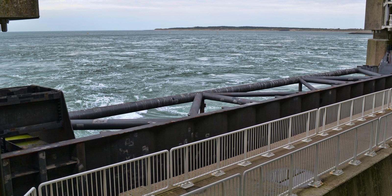
The Oosterscheldekering, part of the Delta Works: Isaï Symens, CC BY-SA 4.0
Low countries
The name Netherlands simply means low lands. The country sits on the deltas of the Rhine, Meuse and Scheldt rivers, and the Dutch government's environmental assessment agency estimates that about 26 percent of the land is below sea level, while about 59 percent is vulnerable to flooding from the sea or the rivers. The lowest point, in the Zuidplaspolder near Rotterdam, is about 6.8 m below sea level.
Many of the country's largest cities, including Amsterdam and Rotterdam, lie partly below the level of the sea. Schiphol airport sits on the bed of a former lake, about 3 m below sea level.
Polders and windmills
A polder is a low area of land surrounded by dikes in which the water level is controlled artificially. From the Middle Ages onward, people built dikes around marshes and lakes and pumped them dry, at first with windmills and later with steam, diesel and electric pumping stations. The Beemster polder, drained in 1612, is a World Heritage Site for its carefully planned grid of fields, roads and canals.
Draining peat land has a cost: as it dries, peat shrinks and oxidises, so the ground sinks and must be pumped ever deeper. The 19 windmills at Kinderdijk, built around 1740 and listed by UNESCO in 1997, are the best-known reminder of how this system looked before modern pumps.
Closing the Zuiderzee
The Zuiderzee was a shallow bay of the North Sea reaching deep into the country. After a severe flood in 1916, the government adopted the plan of engineer Cornelis Lely. The Afsluitdijk, a 32 km dam closed in 1932, turned the salt bay into the freshwater lake now called the IJsselmeer.
Large polders were then drained inside it. Flevoland, made mostly from land that was sea bed until the 1950s and 1960s, became the twelfth Dutch province in 1986, and the Flevopolder is one of the largest artificial islands in the world. Its city, Almere, now has more than 200,000 inhabitants.
The 1953 flood and the Delta Works
On the night of 31 January to 1 February 1953, a severe North Sea storm coinciding with a spring tide broke through dikes across the southwest of the country. In the Netherlands 1,836 people died and large parts of Zeeland and South Holland were flooded.
The response was the Delta Works, built from 1954 to 1997, a chain of dams, sluices and storm surge barriers that shortened the coastline by hundreds of kilometres. The Oosterscheldekering, finished in 1986, is about 9 km long with 62 sliding gates that stay open in normal weather so the tidal estuary and its shellfish survive. The Maeslantkering near Rotterdam, completed in 1997, has two giant floating arms, each about as long as the Eiffel Tower is tall, which swing shut across the shipping channel only when a major storm surge is forecast.
Room for the river
Recent Dutch water policy has shifted from only building higher walls to working with nature. The Room for the River program, carried out mainly between 2006 and 2015, delivered more than 30 projects along the Rhine branches, lowering floodplains, moving dikes inland and digging side channels so rivers can carry more water safely.
On the coast, sand is pumped onto beaches and dunes to keep pace with erosion. The Sand Motor, a hook-shaped peninsula of about 21.5 million m3 of sand built in 2011 south of The Hague, lets waves and currents spread sand along the shore naturally. Engineers from around the world study these ideas as sea levels rise.
- PBL Netherlands Environmental Assessment Agency: Correction wording flood risks
- Wikipedia: Delta Works
- UNESCO: Mill Network at Kinderdijk-Elshout
- Wikipedia: North Sea flood of 1953
Facts on this page were checked against these sources.
- The Oosterscheldekering, part of the Delta Works: Isaï Symens, CC BY-SA 4.0
Text written by Geographical Effect.