Egypt and the Nile Valley
A desert nation threaded by one river. Almost all of Egypt's people live on a thin green ribbon along the Nile. See how one river made a desert country, plus when to visit.
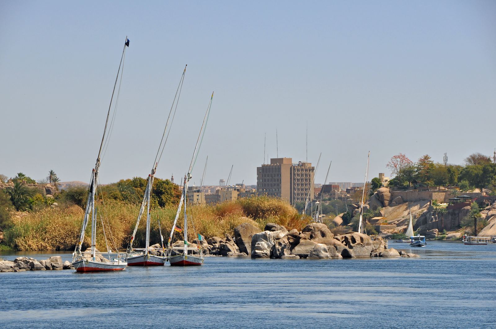
Feluccas on the Nile at Aswan: Marc Ryckaert (MJJR), CC BY 3.0
A country that lives on a ribbon
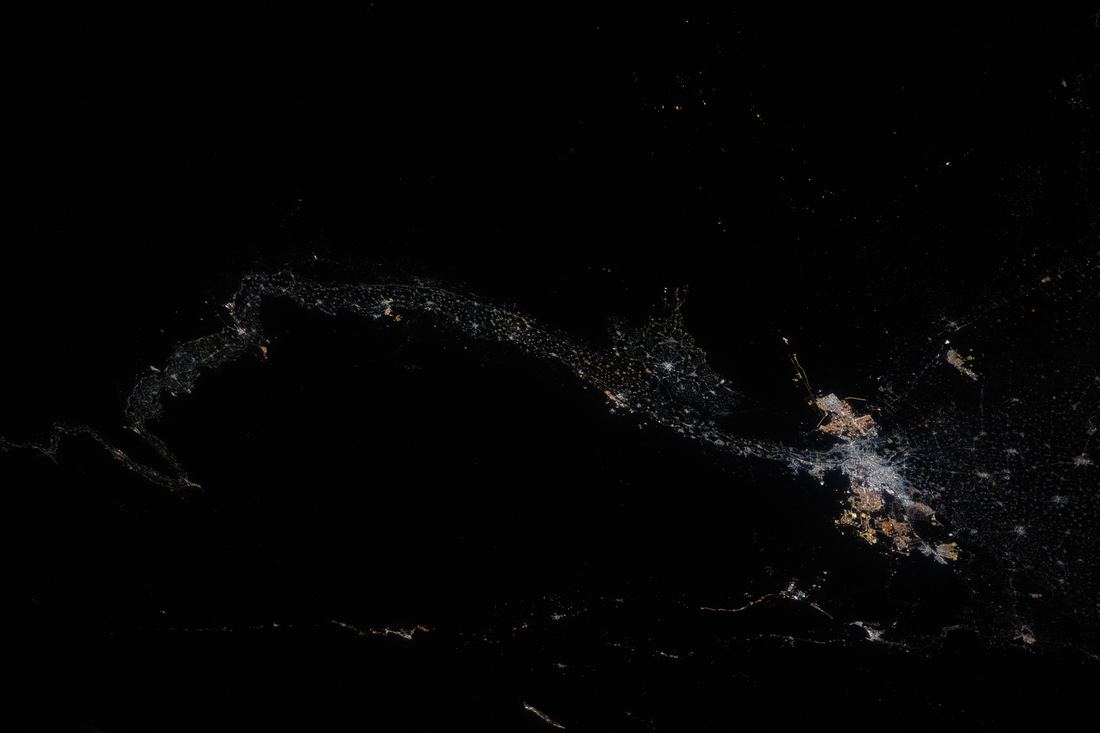
Look at Egypt from orbit at night and the shape is unmistakable: a bright thread running north from Aswan, flaring into a glowing fan at the Mediterranean. That thread is the Nile, and almost everyone in Egypt lives on it or beside it. The rest of the country, more than nine tenths of its land, is open desert where rain may not fall for years.
This is geography at its most decisive. A farm field and a sand dune can sit a few meters apart, divided by the reach of an irrigation canal. Cities, roads, railways and villages crowd the same narrow strip, which is why the valley is one of the most densely settled farming landscapes on Earth.
Video: Essential Nile Cruise (Experience Egypt), embedded from YouTube.
Almost everyone in Egypt lives on a tiny slice of the country
About 95 percent of Egypt's population lives on roughly 5 percent of its land, along the Nile valley and delta.
YouTube @GeographicalEffect (launching soon). Photos in this Short: Nile River Delta at Night.JPG - ISS Expedition 25 crew (Public domain) via Wikimedia Commons | The Nile River Valley and Delta.jpg - NASA Earth Observatory/Suomi NPP (Public domain) via Wikimedia Commons | Aerial view, Cairo (20130330-DSC04095).jpg - Matti Blume (CC BY-SA 4.0) via Wikimedia Commons | ISS035-E-007148 Nile - Sinai - Dead Sea - Wide Angle View.jpg - Expedition 35 Crew Image courtesy of the NASA Johnson Space (Public domain) via Wikimedia Commons | Nile Delta (MODIS 2026-01-04).jpg
The flood that built a civilization
For thousands of years the Nile rose every summer, fed by monsoon rain falling on the Ethiopian Highlands far to the south. The water spread over the valley floor, then drained away and left a layer of dark, fertile silt. Ancient Egyptians called their land Kemet, the black land, after that soil, and they timed their calendar, taxes and harvests to the flood.
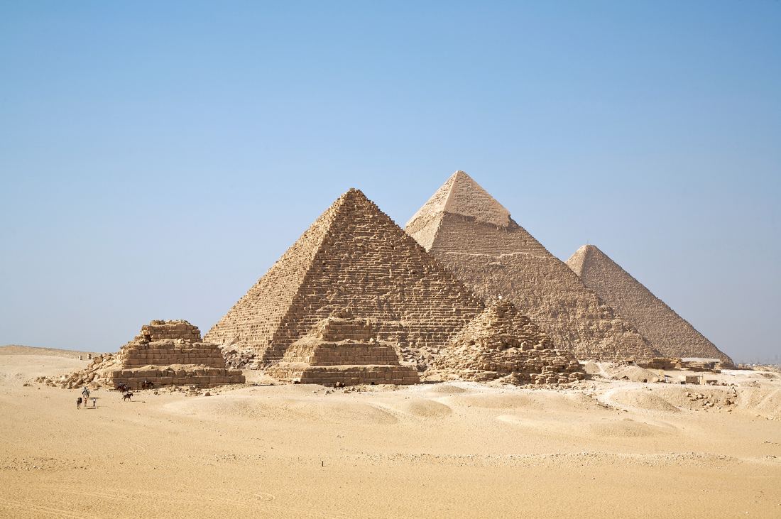
The pyramids of Giza, the temples of Luxor and the tombs of the Valley of the Kings all sit at the edge where green meets desert. Builders put the living on the fertile floodplain and the dead on the dry, rocky ground just beyond it, which helps explain why so much survived.
Taming the river
The Aswan High Dam, finished in 1970, ended the yearly flood. It created Lake Nasser, one of the largest reservoirs in the world, supplied hydropower and allowed farmers to grow crops year round. The trade-off is that silt now settles behind the dam instead of renewing the fields, so farms rely on fertilizer and the delta coastline is slowly retreating.
Today Egypt depends on the Nile for nearly all of its fresh water, and the river's future is a major diplomatic issue. Ethiopia's Grand Ethiopian Renaissance Dam on the Blue Nile, upstream, has been a point of tension for more than a decade.
Planning a visit
The most comfortable months are October through April, when days in Luxor and Aswan are warm rather than scorching. A classic route links Cairo and Giza with a cruise or train south to Luxor and Aswan, where you can sail on a felucca at sunset and visit the temples of Abu Simbel near the Sudanese border.
Summer is quieter and cheaper but brings heat that regularly passes 40 °C in the south. Whatever the season, carry water, start sightseeing early and save the middle of the day for shade, just as Egyptians have always done.
- Britannica: Mount Katrina
- Ahram Online: Egypt's population reaches 108 million: CAPMAS
- Britannica: Nile River, Dams and reservoirs
- Britannica: Aswan High Dam summary
Facts on this page were checked against these sources.
- Feluccas on the Nile at Aswan: Marc Ryckaert (MJJR), CC BY 3.0
- The pyramids of Giza: Ricardo Liberato, CC BY-SA 2.0
- The Nile from orbit: NASA Johnson Space Center, Public domain
- Short photos: Nile River Delta at Night.JPG - ISS Expedition 25 crew (Public domain) via Wikimedia Commons | The Nile River Valley and Delta.jpg - NASA Earth Observatory/Suomi NPP (Public domain) via Wikimedia Commons | Aerial view, Cairo (20130330-DSC04095).jpg - Matti Blume (CC BY-SA 4.0) via Wikimedia Commons | ISS035-E-007148 Nile - Sinai - Dead Sea - Wide Angle View.jpg - Expedition 35 Crew Image courtesy of the NASA Johnson Space (Public domain) via Wikimedia Commons | Nile Delta (MODIS 2026-01-04).jpg - MODIS Land Rapid Response Team, NASA GSFC (Public domain) via Wikimedia Commons | High Aswan Dam (built to control the Nile floods, store water and produce 2,1 GW of electricity) (14284086878).jpg - Jorge Láscar from Melbourne, Australia (CC BY 2.0) via Wikimedia Commons | Cairo, Nile River, Gezira Island, Egypt.jpg - Vyacheslav Argenberg (CC BY 4.0) via Wikimedia Commons | Cairo Nile (2).jpg - Radosław Botev (CC BY 3.0 pl) via Wikimedia Commons
Text written by Geographical Effect.