Iceland
An island built by fire and ice. Iceland sits on the Mid-Atlantic Ridge, with volcanoes under glaciers and waterfalls everywhere. What makes it tick and when to go.
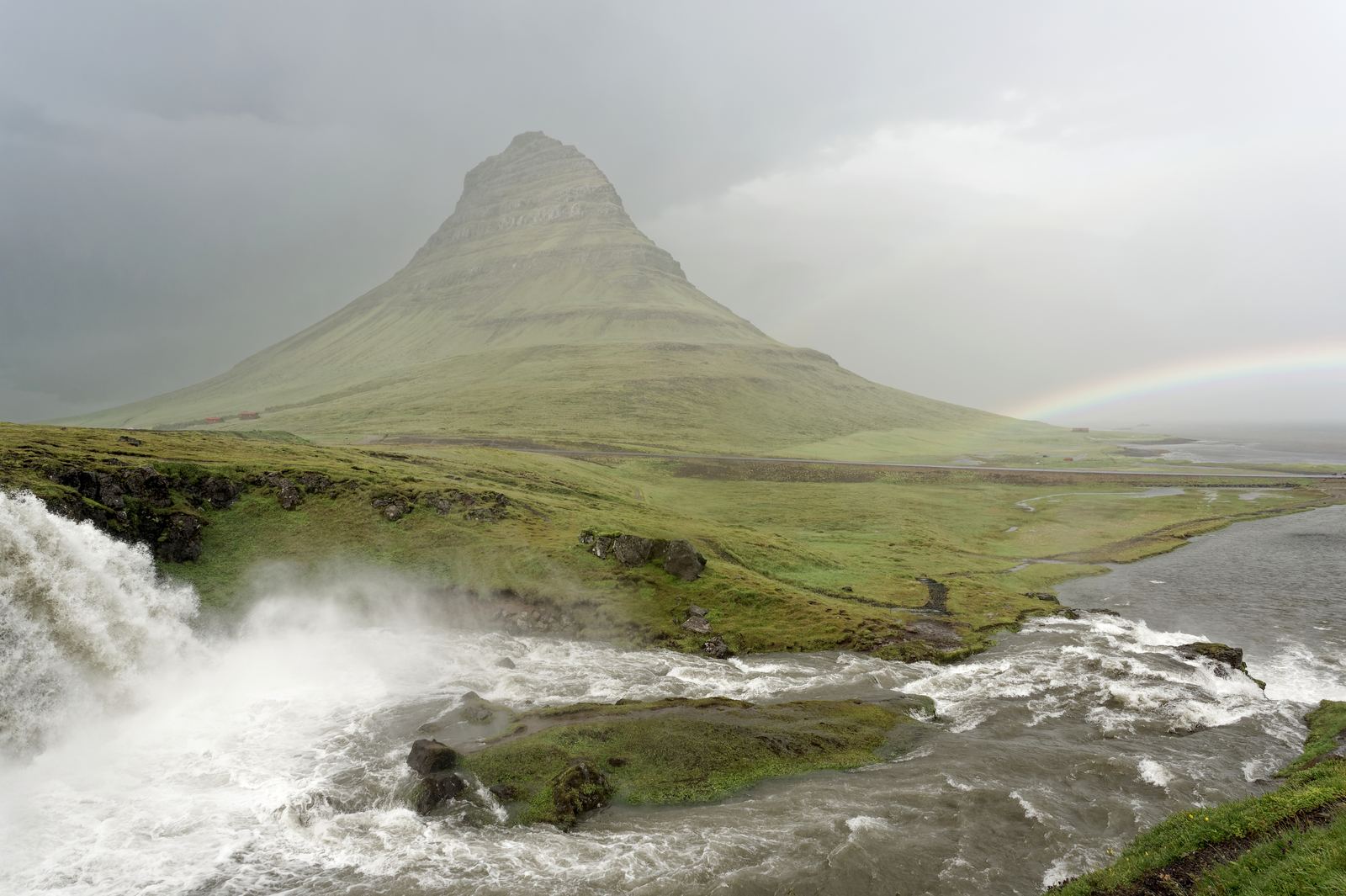
Kirkjufell, west Iceland: Jakub Hałun, CC BY 4.0
Where two plates pull apart
Iceland exists because the North Atlantic is splitting open. The Mid-Atlantic Ridge, where the North American and Eurasian plates drift apart by about two centimeters a year, usually lies deep underwater. In Iceland it comes ashore, boosted by a hotspot of unusually hot mantle beneath the island. At Þingvellir National Park you can walk through a rift valley between two continents, and divers swim in the clear water of the Silfra fissure.
That restless ground makes Iceland one of the most volcanic places on Earth. Since 2021 a string of eruptions on the Reykjanes Peninsula, near the international airport, has sent lava across roads and forced the town of Grindavík to evacuate.
Video: Come and be Inspired by Iceland (Inspired by Iceland), embedded from YouTube.
Fire under the ice
About a tenth of the country is covered by glaciers, and several active volcanoes sit beneath them. When one erupts under ice, the meltwater can burst out in a sudden flood known by its Icelandic name, jökulhlaup. The 2010 eruption of Eyjafjallajökull mixed magma with meltwater and threw fine ash high into the sky, shutting down much of Europe's air traffic for days.
The same heat is also a gift. Nearly all Icelandic homes are warmed by geothermal water, and hydropower and geothermal plants supply almost all of the country's electricity. Hot pools, from village swimming baths to remote natural springs, are a daily part of life.
Waterfalls, black sand and long days
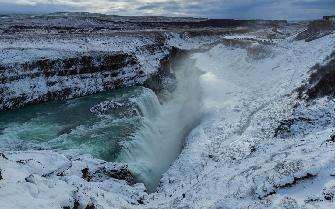
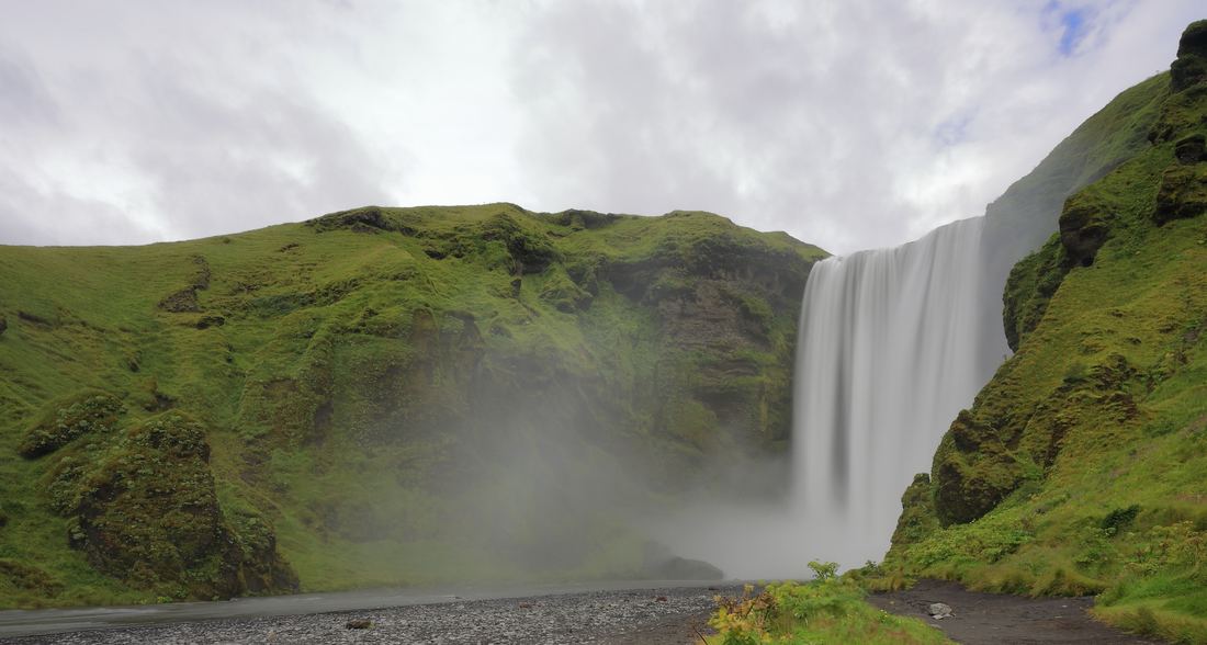
Heavy rain and snow, steep terrain and glacial rivers give Iceland thousands of waterfalls. Gullfoss drops in two steps into a narrow canyon, Skógafoss falls as a single wide curtain, and Dettifoss in the north is one of the most powerful in Europe. Along the south coast, beaches of black volcanic sand meet the Atlantic, and the waves there are dangerously strong.
Iceland lies just below the Arctic Circle, so summer days barely end and winter days are short. That rhythm shapes travel: summer brings midnight sun and open highland roads, while the long dark nights from September to March are the time to look for the northern lights.
Travel tips
The Ring Road, Route 1, loops about 1,300 km around the island and makes a good one to two week trip in summer. Many highland routes are open only to four-wheel-drive vehicles and only for a few months a year. Check road and weather conditions every morning, since wind can close roads and even rip car doors off.
Stay on marked paths around geothermal areas and fragile moss, which can take decades to recover from a single footprint.
- Statistics Iceland: Population on 1 January 2026
- Iceland Review: A Guide to Glaciers in Iceland
- Wikipedia: Hvannadalshnjúkur
- Guide to Iceland: Ring Road Travel Guide
Facts on this page were checked against these sources.
- Kirkjufell, west Iceland: Jakub Hałun, CC BY 4.0
- Gullfoss in winter: Pierre-Selim Huard, CC BY 4.0
- Skógafoss: Martin Falbisoner, CC BY-SA 4.0
Text written by Geographical Effect.