
Eight Famous Hikes and How to Plan Them
These are eight of the walks people dream about, from a half-day climb above Cape Town to a months-long trek across the eastern United States. For each one we pulled the key planning facts from the park service, tourism board or trail organisation that runs it.
Permits, lotteries and hut bookings are where most trips go wrong, so we flag them clearly. Rules change often, so always confirm on the official site before you book anything.
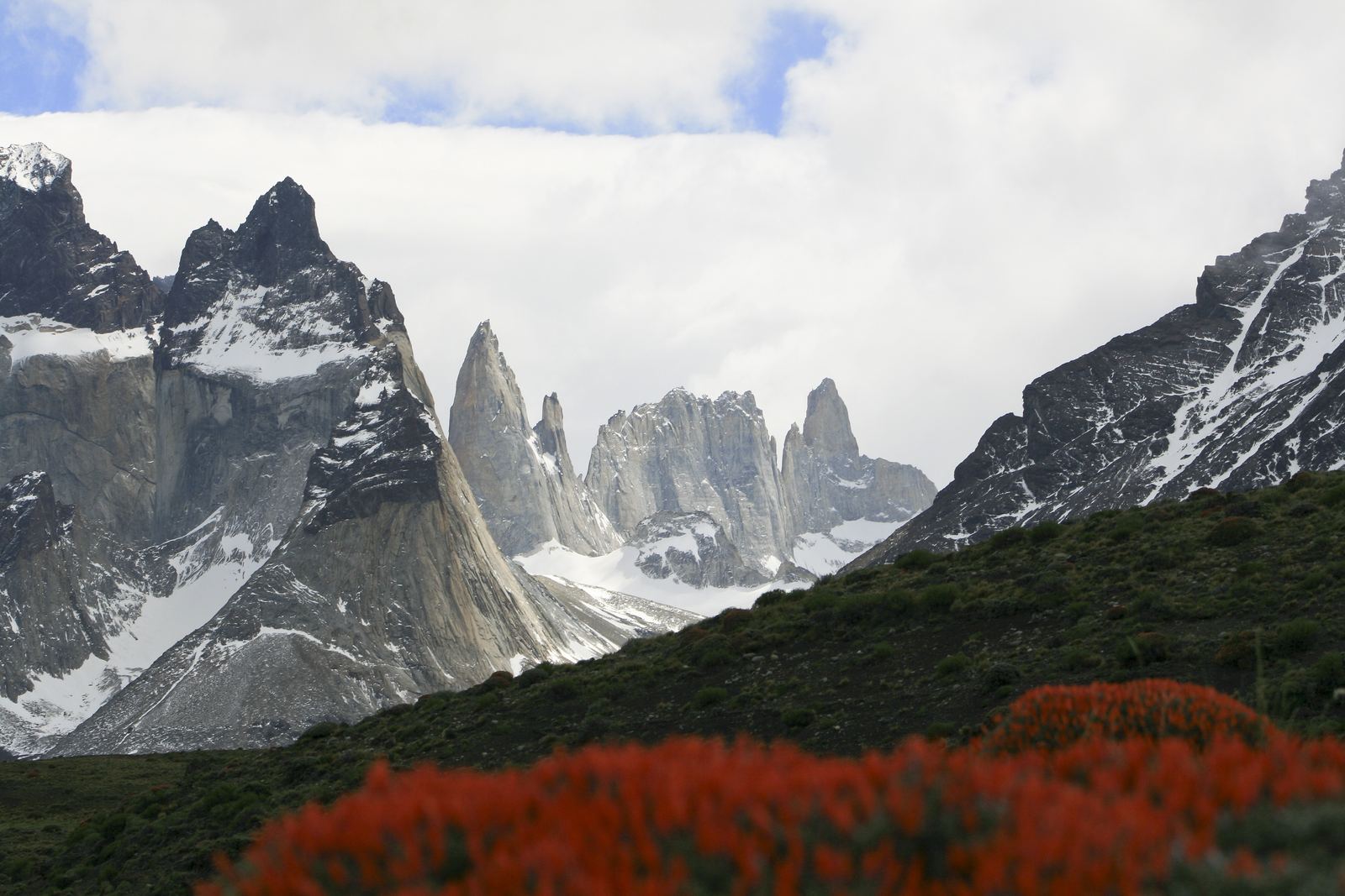
Cuernos and Torres del Paine: Diego Delso, CC BY-SA 3.0
The hikes
Appalachian Trail
A continuous footpath through the eastern mountains from Springer Mountain in Georgia to Katahdin in Maine. Most people walk a section; a full thru-hike is a half-year commitment and only a minority of starters finish.
- Distance
- 2,197.9 miles (about 3,537 km) in 2026
- States
- 14
- Thru-hike time
- 5 to 7 months
- Usual northbound start
- Late February to early April
- Permits
- Needed in some places, including Great Smoky Mountains and Baxter State Park
Northbound hikers must reach Katahdin before Baxter State Park's mid-October cutoff.
W Trek, Torres del Paine
A W-shaped route through Patagonia's most famous park, visiting the granite towers, the French Valley and Grey Glacier. Nights are spent in booked refugios or campsites, and the park ticket must match those bookings.
- Distance
- About 60 km, depending on start and finish
- Typical time
- 4 to 5 days
- Biggest climb
- About 900 m on the Base Torres day
- Best season
- Mid-September to mid-April
- Permits
- Park ticket bought online in advance, plus confirmed lodging
January and February sell out weeks or months ahead. Book lodging first, then the park ticket.
Everest Base Camp Trek
Most trekkers fly from Kathmandu to Lukla and walk up the Khumbu valley through Sherpa villages to the foot of the world's highest mountain. Altitude, not distance, is the real challenge, so the route includes rest days to adjust.
- Start
- Lukla (flight from Kathmandu)
- Base Camp
- About 5,364 m
- Highest viewpoint
- Kala Patthar, about 5,545 m
- Rest stops
- Namche Bazaar and Dingboche
- Permits
- Sagarmatha National Park entry (NPR 3,000 for most foreigners) plus local fees
Nepal's tourism board lists the Everest region among routes where foreign trekkers need a licensed guide. Confirm current rules with a registered agency.
Tour du Mont Blanc
A classic hut-to-hut loop around the Mont Blanc massif, crossing high passes between three countries. Every night ends in a village or mountain hut, so you carry a light pack but need to book beds ahead.
- Distance
- About 170 km
- Total climb
- About 10,000 m
- Countries
- 3
- Typical time
- About 10 days (8 for fast walkers)
- Best season
- Summer, roughly late June to mid-September
Snow can linger on the high passes early in the season. Check trail condition reports.
Table Mountain via Platteklip Gorge
The most direct path up Cape Town's flat-topped mountain, a steep, stepped climb up the gorge in the middle of the front face. The reward is the plateau and a view over the city and the Atlantic, and you can ride the cableway down when it is running.
- Climb
- About 600 m from Tafelberg Road
- Time up
- About 2.5 hours, depending on fitness
- Highest point
- Maclear's Beacon, about 1,086 m
- Routes to the top
- More than 350
- Way down
- Walk, or the cableway (open since 1929) when weather allows
Cloud, wind and mist can arrive fast at any time of year. Never hike alone.
Laugavegur Trail
A highland trek from the rhyolite mountains and hot springs of Landmannalaugar to the green valley of Thorsmork, past obsidian fields, ice caps and black sand deserts. Huts and campsites along the way are run by the Iceland Touring Association.
- Distance
- About 54 km
- Typical time
- 4 days (2 to 3 if fast)
- Season
- About 25 June to 15 September, varies by year
- River crossings
- At least three to wade
- Bookings
- Confirmed hut or campsite bookings expected before you start
Fog and snow are possible even in summer. Leave a travel plan at safetravel.is.
Half Dome
A long, tough day up the granite dome that defines Yosemite Valley, finishing with a hand-over-hand climb up steel cables. Permits are issued by lottery and the cables are only up in the warmer months.
- Distance
- 14 to 16 miles round trip
- Climb
- About 4,800 ft (1,460 m)
- Time
- 10 to 12 hours for most hikers
- Cables up
- Late May to mid-October
- Permits
- Required; preseason lottery in March plus a daily lottery two days ahead
Cable dates can change with conditions. Stay off the cables in thunderstorms.
Angels Landing
A short, very exposed climb along a narrow fin of rock high above Zion Canyon, with chains bolted in for the final stretch. Anyone can hike as far as Scout Lookout; going past it onto the chains needs a permit.
- Distance
- 5.4 miles round trip
- Climb
- About 1,488 ft (454 m)
- Time
- About 4 hours
- Permits
- Required year-round beyond Scout Lookout
- How to get one
- Seasonal lottery or the day-before lottery
Not for anyone uneasy with heights. Avoid it in wet or icy conditions.
Read the full place guides
Torres del Paine and the W Trek
How Patagonia's wind, ice and granite shaped one of the world's great parks.
Cape Town and Table Mountain
A city built around a mountain and its rare plant life.
Staying safe on the trail
What should I always carry, even on a day hike?
The US National Park Service recommends the ten essentials: navigation, sun protection, extra clothing, a light, first aid, fire, a repair kit, extra food, water with a way to treat it, and emergency shelter. Our packing checklist covers them.
Who should know where I am going?
Always leave a trip plan with someone who is not coming: your route, who is with you and when you expect to be back. In Iceland you can also file a travel plan at safetravel.is, and the emergency number there is 112.
How do I avoid altitude sickness on a trek like Everest Base Camp?
Go up slowly. The US CDC advises that above 3,000 m you raise your sleeping altitude by no more than 500 m a day and add a rest day for every extra 1,000 m. A headache with nausea, dizziness or tiredness is a warning sign: never climb higher with symptoms, and go down if they get worse.
When should I turn back?
Decide on a turnaround time before you start and stick to it, even if the top is in sight. Bad weather, a slow group or failing light are all good reasons to call it a day.
Do I really need to book permits months ahead?
For the busiest trails, yes. Half Dome and Angels Landing use lotteries, the W Trek fills up in January and February, and Laugavegur huts are booked well in advance. Check the official site as soon as you pick your dates.
Trail conditions, permit rules and opening dates change every season. The facts here were checked on 1 October 2026; confirm everything with the official park or trail site before you go, and be ready to turn back.
- Appalachian Trail Conservancy: A.T. Basics
- Appalachian Trail Conservancy: Thru-Hiking
- Appalachian Trail Conservancy: 2026 official mileage
- Patagonia Tourism: Torres del Paine tickets
- Swoop Patagonia: W Trek guide
- Nepal Tourism Board: Everest
- Nepal Tourism Board: Park entry fees
- Nepal Tourism Board: TIMS card
- Wikipedia: Everest base camps
- Autour du Mont-Blanc: Tour du Mont Blanc
- Wikipedia: Table Mountain
- University of Cape Town: 33 cool facts about Table Mountain
- Table Mountain Aerial Cableway: trails and safety
- Ferdafelag Islands: Laugavegur trail
- Ferdafelag Islands: Safety
- NPS Yosemite: Half Dome
- NPS Zion: Angels Landing permits
- NPS: Hike Smart
- CDC Yellow Book: High-altitude travel and altitude illness
Facts on this page were checked against these sources (updated Oct 1, 2026). Spot an error? Email hello@fireempireshop.com.