Great Barrier Reef
The largest living structure on Earth. About 2,900 individual reefs and 900 islands along 2,300 km of the Queensland coast. How corals build it, why it bleaches, and how to visit in a way that helps.
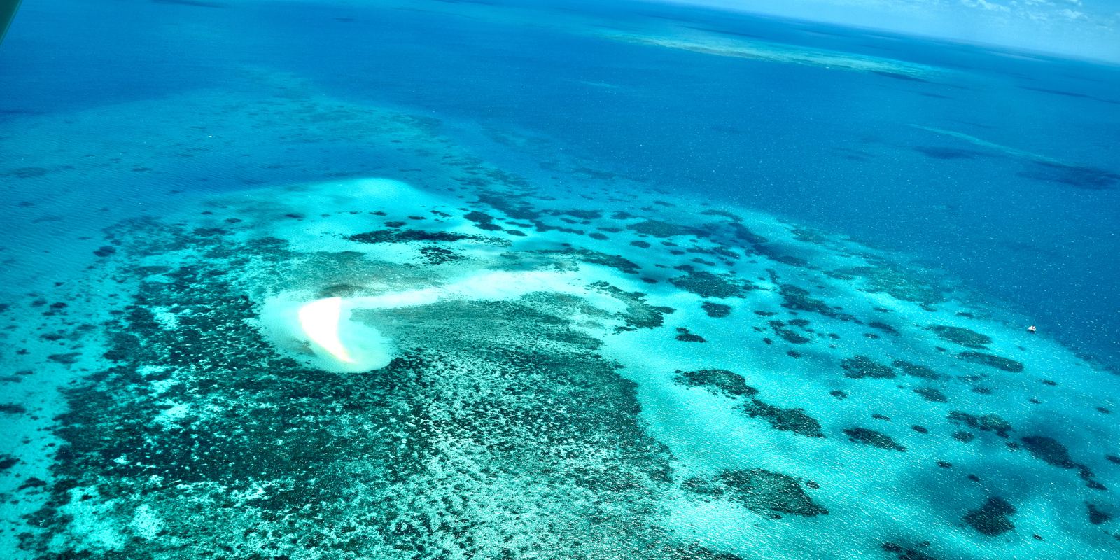
Aerial view of the Great Barrier Reef: Ank Kumar, CC BY-SA 4.0
Built by tiny animals
The Great Barrier Reef is not one reef but a system of more than 2,900 separate reefs and about 900 islands stretching about 2,300 km along the coast of Queensland, Australia. It was built by coral polyps, small soft-bodied animals related to jellyfish, which take calcium carbonate from seawater and lay down hard skeletons. Over thousands of years those skeletons pile up into reefs big enough to see in photographs taken from orbit.
Most reef-building corals live in partnership with microscopic algae called zooxanthellae that live inside their tissues. The algae use sunlight to make food and share it with the coral, which is why reefs grow in clear, shallow, warm water and why corals are so colourful.
Young reef, ancient coast
The living reef we see today is geologically young. During the last ice age, sea level was about 120 m lower and the reef's current position was dry coastal plain. As the ice melted and the sea rose, from about 20,000 years ago, corals colonised the newly flooded shelf; the present reef has mostly grown in the last 6,000 to 9,000 years, on top of older reef layers.
The reef holds an enormous range of life. The Great Barrier Reef Marine Park Authority lists more than 1,600 species of fish, around 600 types of hard and soft coral, more than 130 kinds of sharks and rays, over 30 species of whales and dolphins, and six of the world's seven species of marine turtle.
Why corals bleach
When the water stays too warm for too long, the partnership between coral and algae breaks down. The coral expels its algae and turns white, which is called bleaching. Bleached coral is still alive and can recover if temperatures drop soon enough, but long or severe heat kills it.
The reef has had mass bleaching events in 1998, 2002, 2016, 2017, 2020, 2022 and 2024, driven by marine heatwaves linked to a warming climate. Other pressures include outbreaks of the coral-eating crown-of-thorns starfish, cyclones, and sediment and fertiliser washing off the land. Scientists from the Australian Institute of Marine Science survey the reef every year, and some areas have shown strong coral regrowth between events.
Seeing it
The main gateways are Cairns and Port Douglas in the north, close to the outer reef, and Airlie Beach for the Whitsunday Islands and the famous swirl of white sand at Whitehaven Beach and Hill Inlet. Day boats run to pontoons and reef sites; liveaboard boats reach more remote reefs. You can also snorkel straight off the beach on some islands, such as Lady Elliot and Heron Island in the south.
June to October is usually drier, cooler and calmer. From roughly November to May, box jellyfish and the tiny Irukandji jellyfish can be present in coastal waters, so operators provide full-body lycra stinger suits; wearing one is a simple, effective precaution.
Visiting without harming it
Choose operators certified under the Marine Park Authority's high standard tourism program, never stand on or touch coral, and keep fins up and away from the reef. Use sunscreen sparingly and wear a rash shirt instead, and follow the zoning maps if you fish or boat on your own, since green zones are closed to all fishing.
Part of every visitor's ticket includes the Environmental Management Charge, which funds reef management. Some tour companies also run citizen science programs such as Eye on the Reef, in which visitors log what they see to help scientists track change.
- Wikipedia: Great Barrier Reef Marine Park
- Wikipedia: Coral bleaching
- UNESCO: Great Barrier Reef
- Wikipedia: Great Barrier Reef
Facts on this page were checked against these sources.
- Aerial view of the Great Barrier Reef: Ank Kumar, CC BY-SA 4.0
Text written by Geographical Effect.