Grand Canyon
A mile of rock, two billion years of time. The Colorado River cut a canyon 446 km long and 1.6 km deep. How it formed, why the two rims differ, and how to hike it safely.
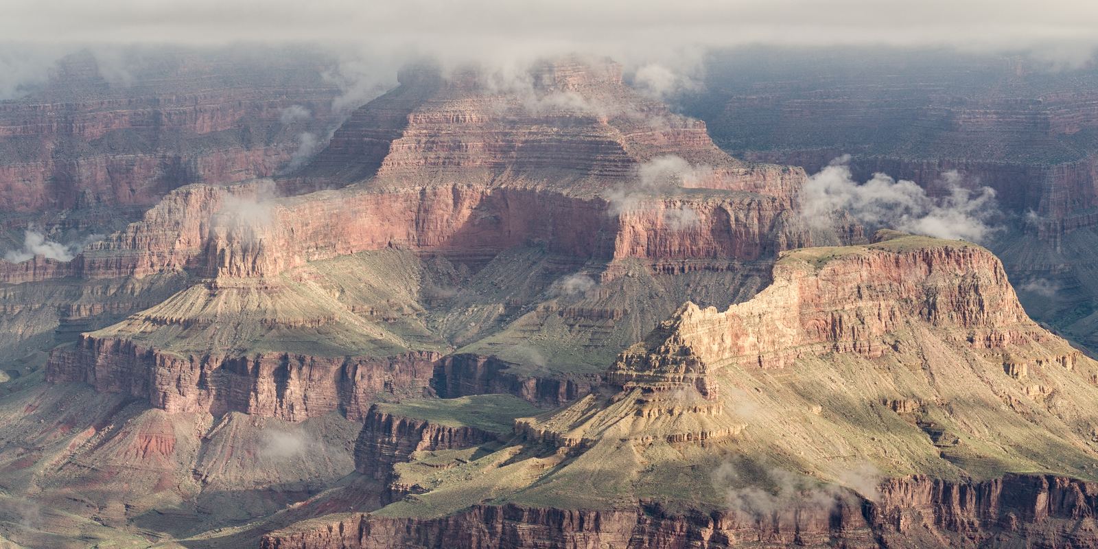
The Grand Canyon from Mather Point: Tuxyso, CC BY-SA 3.0
A river and a rising plateau
The Grand Canyon is what happens when a powerful river meets land that is slowly being pushed upward. The Colorado Plateau rose over millions of years, and the Colorado River kept cutting down through it, carrying sand and gravel that scoured its bed like sandpaper. Most geologists think the canyon as we see it took shape over roughly the last five to six million years, although parts of it may follow older valleys.
Side canyons, rain, frost and rockfalls did the widening. Water freezes in cracks on winter nights, expands and pries blocks loose, while summer storms flush debris down into the river. That is why the canyon is far wider than the river that made it.
Reading the walls
The walls are a stack of rock layers that work like a timeline. At the bottom, in the Inner Gorge, the dark Vishnu Basement Rocks are close to 1.8 billion years old. Above them sit sandstones, shales and limestones laid down in shallow seas, beaches, deltas and deserts. The pale Kaibab Limestone on the rim is about 270 million years old and holds fossils of sea creatures, which surprises many visitors standing more than 2,000 m above sea level.
There is a famous gap in the record called the Great Unconformity, where rocks hundreds of millions of years apart sit directly on top of each other because the layers in between were eroded away before new ones were deposited.
Two rims, two climates
The South Rim sits at about 2,100 m and is open all year, with the visitor centre, Mather Point and the historic Grand Canyon Village. The North Rim is roughly 300 m higher, gets much more snow, and its roads and services normally open only from mid-May to mid-October. Straight across, the rims are about 16 km apart, but the drive between them is around 350 km.
Going down into the canyon is like travelling from southern Canada to the deserts of Mexico. Pine and fir forests on the North Rim give way to pinyon and juniper, then to desert scrub. At Phantom Ranch, beside the river, summer afternoons often pass 43 C (110 F), while the rim above can be pleasantly cool.
Hiking it safely
The two classic trails from the South Rim are the Bright Angel Trail, which has water stations in season and shade in places, and the steeper South Kaibab Trail, which has wide views but no water. The National Park Service advises against trying to hike from the rim to the river and back in one day, especially in summer, and park rangers rescue hundreds of hikers every year, most of them suffering from heat and exhaustion.
The canyon is upside down compared with a mountain: the easy part comes first and the hard climb comes at the end, when you are tired and the day is hottest. Start before dawn, turn around when a third of your water or energy is gone, eat salty snacks as well as drinking, and rest in shade from roughly 10 am to 4 pm. Overnight camping below the rim needs a backcountry permit, and spaces at Phantom Ranch are given by lottery.
People of the canyon
The canyon has been home to people for thousands of years. The park recognises eleven tribes with traditional ties to it, and the Havasupai people still live in the village of Supai in a side canyon, famous for its blue-green waterfalls. Visiting Havasu Falls requires a permit from the Havasupai Tribe, not from the national park.
Today the park receives close to five million visitors a year, most of them at the South Rim. Arriving early, using the free park shuttle buses and walking even a short way along the Rim Trail are the easiest ways to find quieter viewpoints.
- National Park Service: Grand Canyon geology
- National Park Service: Hiking safety at Grand Canyon
- National Park Service: Grand Canyon park statistics
- Wikipedia: Grand Canyon
Facts on this page were checked against these sources.
- The Grand Canyon from Mather Point: Tuxyso, CC BY-SA 3.0
Text written by Geographical Effect.