
South Georgia
Capital, major cities, population, maps, climate, landscapes and landmarks of South Georgia, in Antarctica.
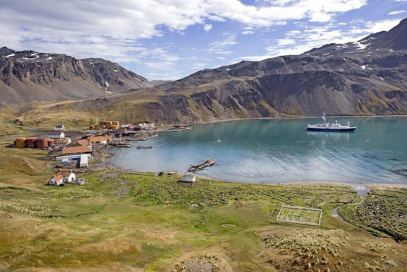
Grytviken Harbour, Island of South Georgia, United Kingdom: Lexaxis7, CC BY-SA 3.0 (Wikimedia Commons)

Overview
South Georgia is a country or area in Antarctic. It covers about 3,903 km² (1,507 sq mi), the 178th largest of the 250 countries and areas in our atlas, and is home to roughly 30 people (246th by population). That works out to about 0 people per km².
South Georgia has no land borders: it is surrounded by water. The highest point is Mount Paget at 2,934 m (9,626 ft).
The largest city in our atlas is Grytviken, with about 2 people in the city proper. The official language is English. Clocks run on UTC-02:00.
Where is South Georgia?
Highlighted shape and city dots (green = major cities). Map data: Natural Earth (public domain); shapes are simplified and do not represent any position on boundaries.
Major cities
| City | Region | Population |
|---|---|---|
| Grytviken | 2 |
City-proper populations from GeoNames; metropolitan areas are often much larger.
Climate
Grytviken has a tundra climate (Köppen ET). The warmest month is usually Feb, with average highs near 4°C (39°F); the coolest nights come in Aug at about -4°C (25°F). Around 1,094 mm (43 in) of rain and snow falls in a typical year, spread fairly evenly through the year.
Bars: average daily high and low (°C) for each month; blue columns and figures: average precipitation (mm). Gridded 2001-2025 averages from NASA POWER, so mountain and coastal spots can differ from local station records.
Fun geography facts
- South Georgia is the 178th largest country or area by land and water area in our atlas.
- It lies in the Southern Hemisphere, so summer falls in December, January and February.
- Grytviken gets about 1,094 mm of precipitation a year (tundra climate).
- It is one of the most sparsely populated places on Earth, with lots of open land per person.
More in Antarctic
- Country names, codes, languages, currencies, area: mledoze/countries (ODbL), the dataset behind REST Countries
- Population: World Bank (CC BY 4.0), else GeoNames
- Cities, time zones, elevations: GeoNames (CC BY 4.0)
- Geography and landmarks: Wikidata Q35086 (CC0)
- Climate: NASA POWER 2001-2025 climatology
- Map: Natural Earth (public domain)
Text written by Geographical Effect from these sources. Spot an error? Email hello@fireempireshop.com.
- Grytviken Harbour, Island of South Georgia, United Kingdom: Lexaxis7, CC BY-SA 3.0 (Wikimedia Commons)